Dear APIS users,
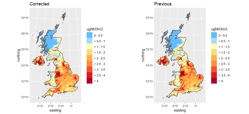
We have noticed a mapping error in the ammonia data of the CBED data 2018-2020. That translates also to an error in the total nitrogen deposition. The origin of the error is an R software update problem using the library 'proj4' to project to BNG which did not project correctly. This function has now been updated with the library 'proj6' which does it correctly. You will see below this error resulted in the grid being shifted a few km north (see the south of the UK in ‘Previous’ map (right) where we have a blue band at the bottom).

We have listed which sites (SPA, SAC and A/SSSI) that are now exceeded and which ones are no longer exceeded to help you make any further assessments. Please see the spreadsheet with the corrected data below to check which sites are affected.
We apologise for any inconvenience this has caused. Further QC checks have been put in place to help prevent this type of error occurring again.
As an update, we will release a new year for CBED and APIS - 2019-2021 in the next 2 months.
The APIS team
